Lebanon’s Wildfires Devour 25 Million M2 Annually
Status quo
Lebanon stretches over 10,452 Km2, with the barrens, pastures and rivers covering 53% of its area, i.e. 5,510 km2. Green spaces make up 34% or 3,538 km2 of Lebanon and are distributed between agricultural swathes (25% or 2,600 km2) and forestry (9% or 936 km2). Roads and residential and urban areas cover 13% or 1,352 km2 of Lebanon.
Wildfires
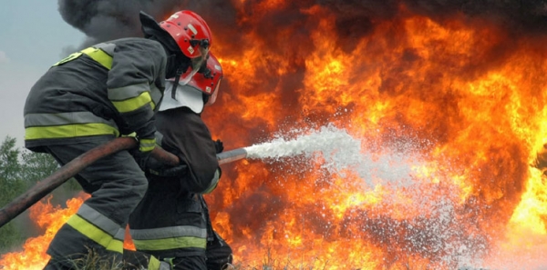
Every year, by the end of the summer season, huge fires sweep over massive tracts of vegetation across Lebanon, razing forests and pastures and crops to the ground. Given their modest resources and capabilities, firefighting units stand helpless before the blazing flames. The tragedy plays itself out repeatedly every year, without any solution in sight to address future fires. Even the fire-fighting helicopters bought in hope of extinguishing the fires have proved to be ineffective and below expectations. It is said that many of these forest-fires are man-made for construction or heating purposes.
Table 1 illustrates the green spaces consumed by fire and turned into ashes in the past few years. The flames spread over 183 million m2, accounting for 1.75% of Lebanon’s area, and reforestation was not initiated except in very limited areas.
|
Green spaces consumed by fires in the past few years |
Table 1 |
|
|
Year |
Green spaces consumed by fires (million m2) |
|
|
2006 |
34 |
|
|
2007 |
31 |
|
|
2008 |
27 |
|
|
2009 |
20 |
|
|
2010 |
16 |
|
|
2011 |
30 |
|
|
2012 |
25 |
|
|
2013 |
32 |
|
|
Total |
215 |
|
Source: Archives of Lebanese newspapers
Green Lebanon is at risk of receding drastically in the coming decades if no efforts are made to resolve the hazards threatening its vegetation, particularly by the wildfires.


Leave A Comment